Brighton Tram 53 Society — Tram Routes
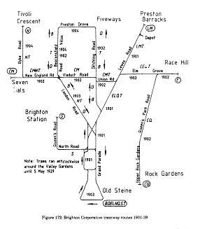
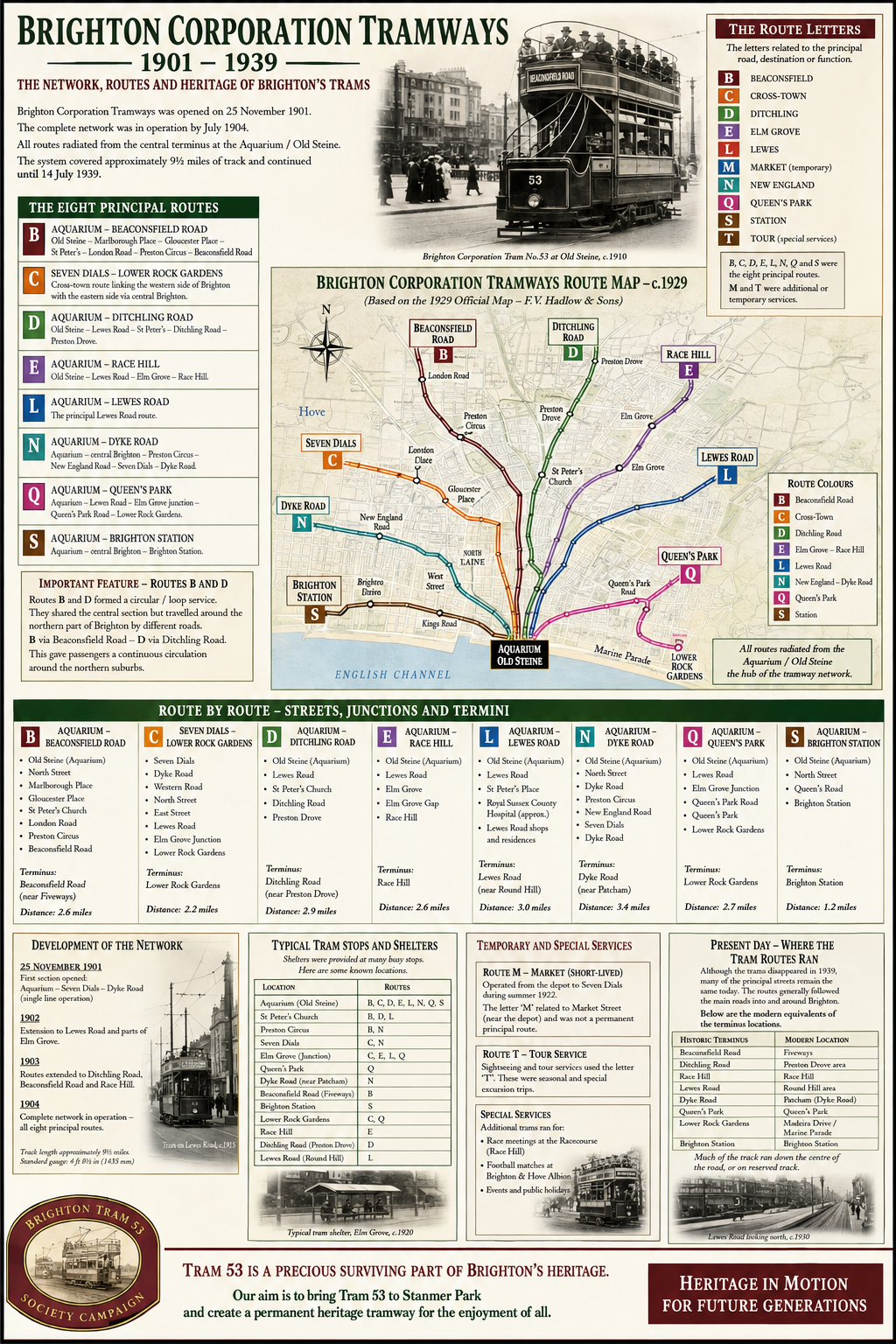
Routes at a glance
B Aquarium - Beaconsfield Villas - Circular Route
C Seven Dials – Lower Rock Gardens
D Aquarium - Preston Drove - Circular Route
E Aquarium - Race Hill/Elm Grove
L Aquarium - Lewes Road
N Aquarium - Dyke Road
M Market Street - Seven Dials - only used in 1922
Q Aquarium - Lower Rock Gardens
S Aquarium - Brighton Station
T Seasonable - Excursions - Sight seeing around town - starting Aquarium terminus
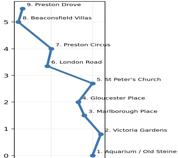
Route B: Aquarium – Beaconsfield Road
Aquarium → Marlborough Place → Gloucester Place → St Peter's Church →London Road → Preston Circus → Beaconsfield Road / Beaconsfield Villas → Preston Drove.
Documented tram shelters:
Beaconsfield Villas / Stanford Avenue (1912) Top of Beaconsfield Villas / Preston Drove (1913)
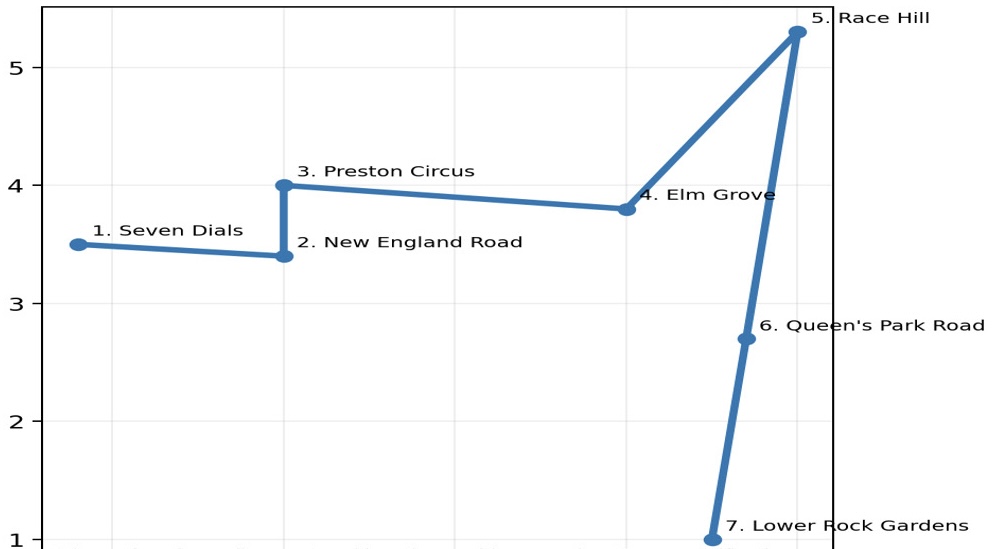
Route C: Seven Dials – Lower Rock Gardens
Aquarium → Marlborough Place → Gloucester Place → St Peter's Church →London Road → Preston Circus → Beaconsfield Road / Beaconsfield Villas → Preston Drove.
Documented tram shelters:
Seven Dials, south side Chatham Place / Buckingham Place (1913)Preston Circus, police-station lean-to (1919) Top of Viaduct Road / Ditchling Road (1921)
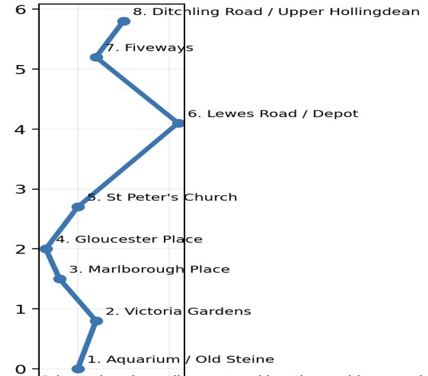
Route D: Aquarium – Ditchling Road
Aquarium → Marlborough Place → Gloucester Place → St Peter's Church →Lewes Road → Ditchling Road → Preston Drove / Fiveways
Documented tram shelters:
Preston Drove / Ditchling Road (Fiveways) (1911)
Ditchling Road / Upper Hollingdean Road (1911)
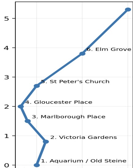
Route E: Aquarium – Race Hill
Aquarium → central Brighton → St Peter's Church → Waterloo Place → Elm Grove → Race Hill.
Documented tram shelters:
Elm Grove, north side opposite Queen's Park Road and later toward the top of Elm Grove (1924/25)
Route L: Aquarium – Lewes Road
Aquarium → Marlborough Place → Gloucester Place → St Peter's Church →Lewes Road Barracks / Preston Barracks
Documented tram shelters:
Lewes Road east side by Woodvale Cemetery (1914) Lewes Road east side opposite Union Road (1914) St Peter's Church, Lewes Road (1925)
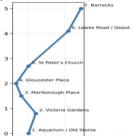
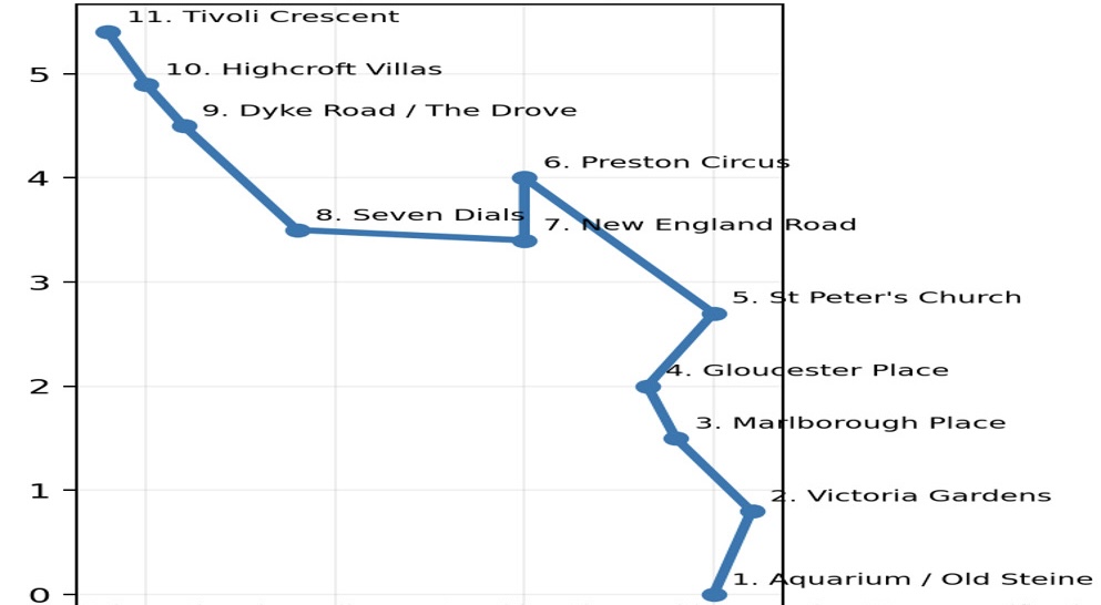
Route N: Aquarium – Dyke Road
Aquarium → central Brighton → Preston Circus → New England Road →Seven Dials → Dyke Road → The Drove / Highcroft Villas → Tivoli Crescent North.
Documented tram shelters:
Dyke Road / The Drove (1911) Dyke Road / Tivoli Crescent North terminus (1916) Dyke Road / Highcroft Villas (1928) Dyke Road opposite Port Hall Road (1930)
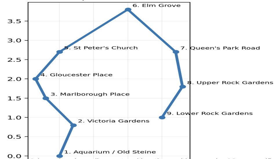
Route Q: Aquarium – Queen's Park
Aquarium → Lewes Road/Elm Grove junction → Queen's Park Road →Queen's Park → Lower Rock Gardens.
Documented tram shelters:
Upper Rock Gardens terminus, top of St James's Street (1910) Queen's Park Road / Pepper Pot (1914)
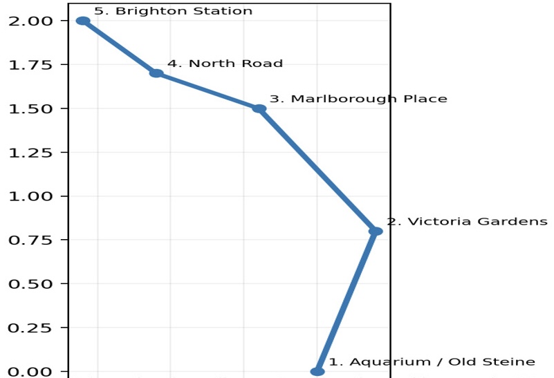
Route S: Aquarium – Brighton Station
Aquarium → Marlborough Place → North Road → Queen's Road → Brighton Station.
Documented tram shelters:
Victoria Gardens opposite North Road (1911)